North Cascades - Ptarmigan Loop
Many moons ago, I read this article about the thrilling and beautiful Ptarmigan Traverse - a high route through the rugged terrain of the North Cascades, a mix of glacier and rock and trail travel. I was sold and began scheming to do it one day. Ross is a pretty easy sell - I think he had also heard of the route - and so we began planning in earnest.
The route is deceptively short, around 30 miles, traditionally split over 5 days. This, as we will learn, is for good reason. The terrain is never flat for long, route finding can be complicated and is very serious business, the exposure is real as the trail crosses snowfields, cliffs, and glaciers with thousands of feet of air below you.
Typically, the route is done as a North to South traverse, with a long car shuttle serving as the bookends to the trip. We didn’t have a second car free to do the shuttle and, frankly, even if we had I didn’t want to drive that many hours before AND after the trip. In a bit of blatant foreshadowing, let’s say that it became very clear why the exit is done with two cars… Anyway, we planned a loop, exiting out the rarely used South Fork Cascade Trail.
Ross arrived on Friday morning and we left that afternoon, intending to sleep near the trailhead after picking up some last minute gear.
Here’s our route:
Full resolution pictures are hosted here
Day 1 - Cascade Pass Trailhead to Kool-Aid Lake
Our morning starts in heavy fog and the sound of other hikers busily covering themselves in deet and packing bags. We were initially a concerned with the sheer volume of folks in the lot! But it turned out that they were almost all day hiking Boston Basin or another trail in the North Cascades and when we turned off onto a tiny, unmarked dirt trail onto the traverse the crowds disappeared. From here on out we would see seven people total the next 5 days.
We made quick time through the fog and down the trail to Kool-Aid.

We set up the tent and Ross promptly crawled inside to take a nap! Ross had had a busy few days! After he woke up, we scrambled up nearby Magic Mountain.

In the afternoon we scrambled up nearby Magic Mountain for some classic Cascade views and climbing.

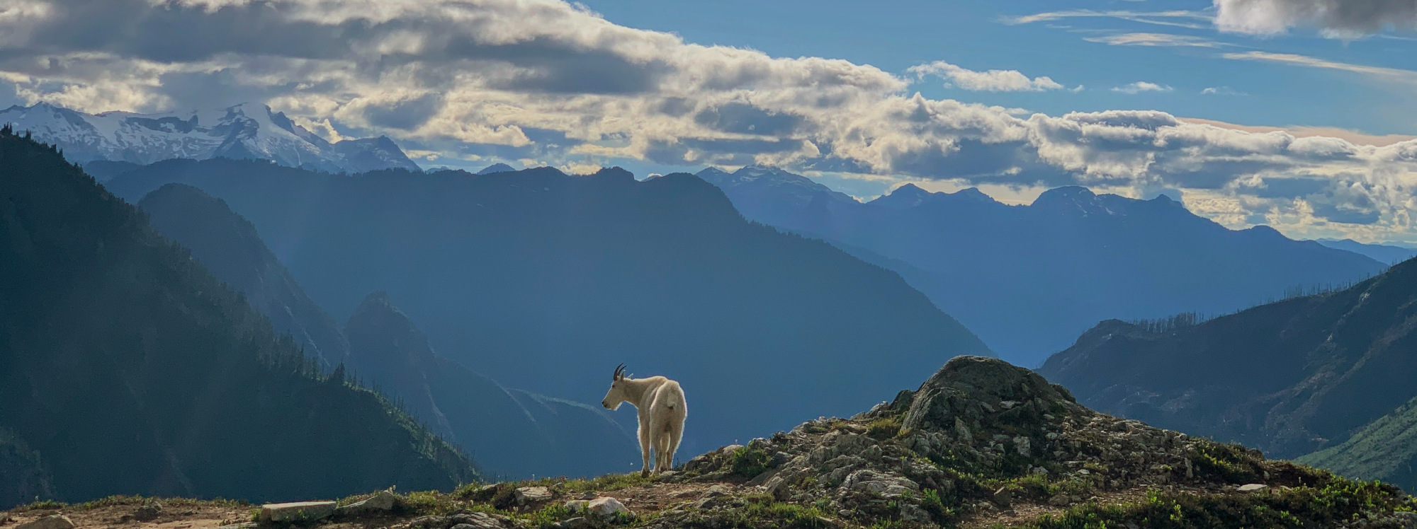
That evening, we were visited by a BEAUTIFUL mountain goat. Honestly, folks, this goat was…buff? The coat was incredible. I don’t really get it. Also it seemed to be posing? Anyway, we seemed to develop a pretty good rapport.

The evening turned out to be truly spectacular. Although Mount Formidable, true to its name, stayed shrouded in clouds all night.
Day 2 - Kool-Aid Lake to Yang Yang Lake
The next morning we woke up to blue skies and packed up with glee - excited to dive deeper into the wilderness. The trail crosses a loose scree field and then up a narrow and improbable track through a cliff band called the “Red Ledges”.

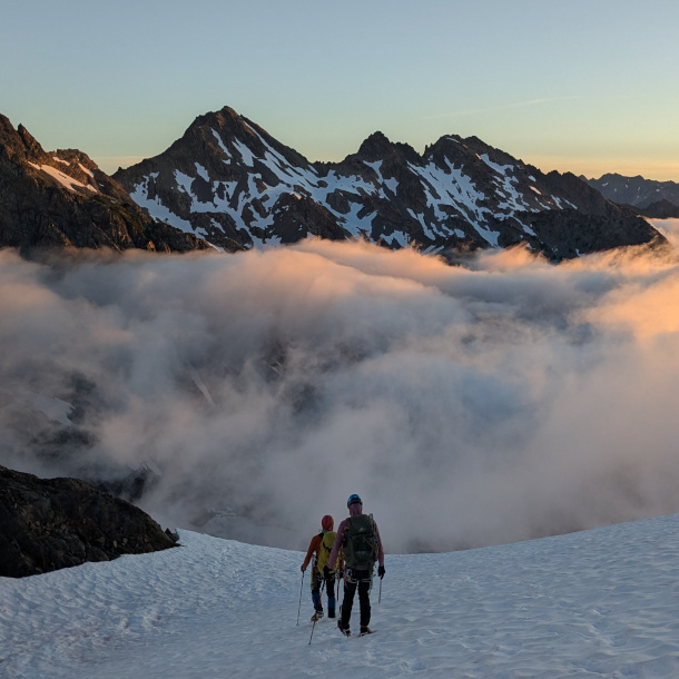
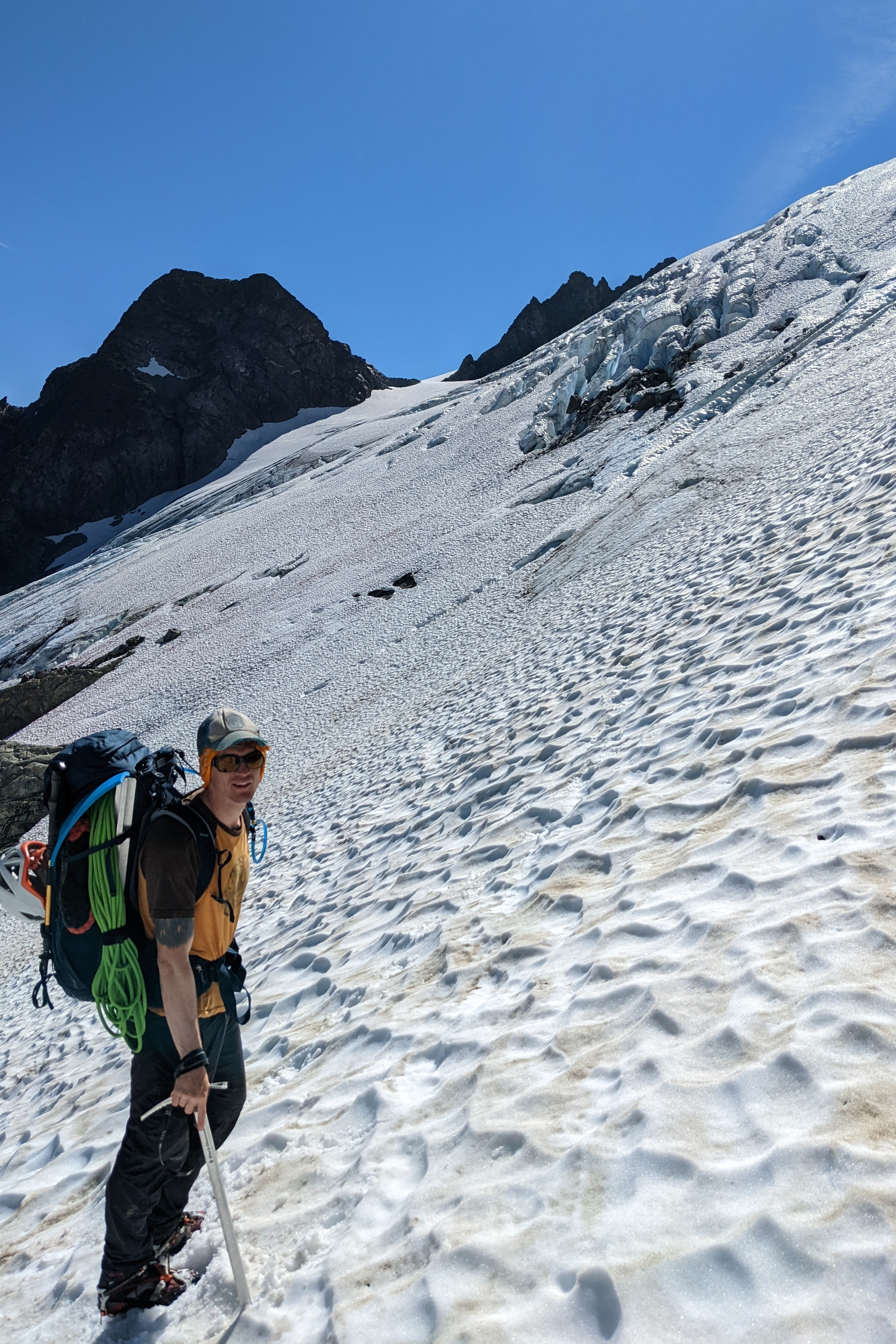
We roped up for the glacier under Formidable before crossing the pass into a massive basin above Flat Creek. The basin is a massive horseshoe, you can see the camp you’re aiming for nearly all day.


Day 3 - Yang Yang Lake to White Rock Lakes
This stretch is unreal and has got to be one of the most scenic 5 miles I’ve ever done. We left Yang Yang Lakes headed back up to the ridge, immediately gaining about 1000ft of elevation directly out of camp.

Once you gain the ridge, you get to drop all that elevation again! Down the snow slopes below Le Conte Mountain for a long snow crossing. To exit, you need to climb straight up to a pass between Spire and Old Guard, staying well clear of the gaping crevasses on either side.

From the saddle, it’s a pretty comfortable snow crossing to a ridge above South Cascade Glacier and from there, you just need to navigate mere 600 vertical feet of snow and rocks to get to a picturesque camp at White Rock Lakes.


Day 4 - White Rock Lakes to Some Random Spot along Drop Creek
Our original plan had been to double back and exit out the South Cascade River trail coming down the South Cascade Glacier. This is quite notorious as all 5 people we met were all a bit taken aback. The trail has been unmaintained for years and is brushy and overgrown, horrendous to navigate. On day 3, we scrambled near the summit of German Helmet Butte and there we found a wonderful and kind North Cascades guru, Kevin, who had been in the area for 10+ days and seemed to know the ins and outs of all the ridges and drainages. He suggested that instead of the river trail, we drop into High Log Creek to Drop Creek, hitting the river trail at an angle and cutting off many miles of bushwacking. Insanely, Ross and I both quickly agreed to this plan. Kevin sounded as confident as Ross and I were unconfident, describing only one short section of “steep trees”. This, naturally, would be an understatement.
In the morning, we left camp headed north, back over the pass.

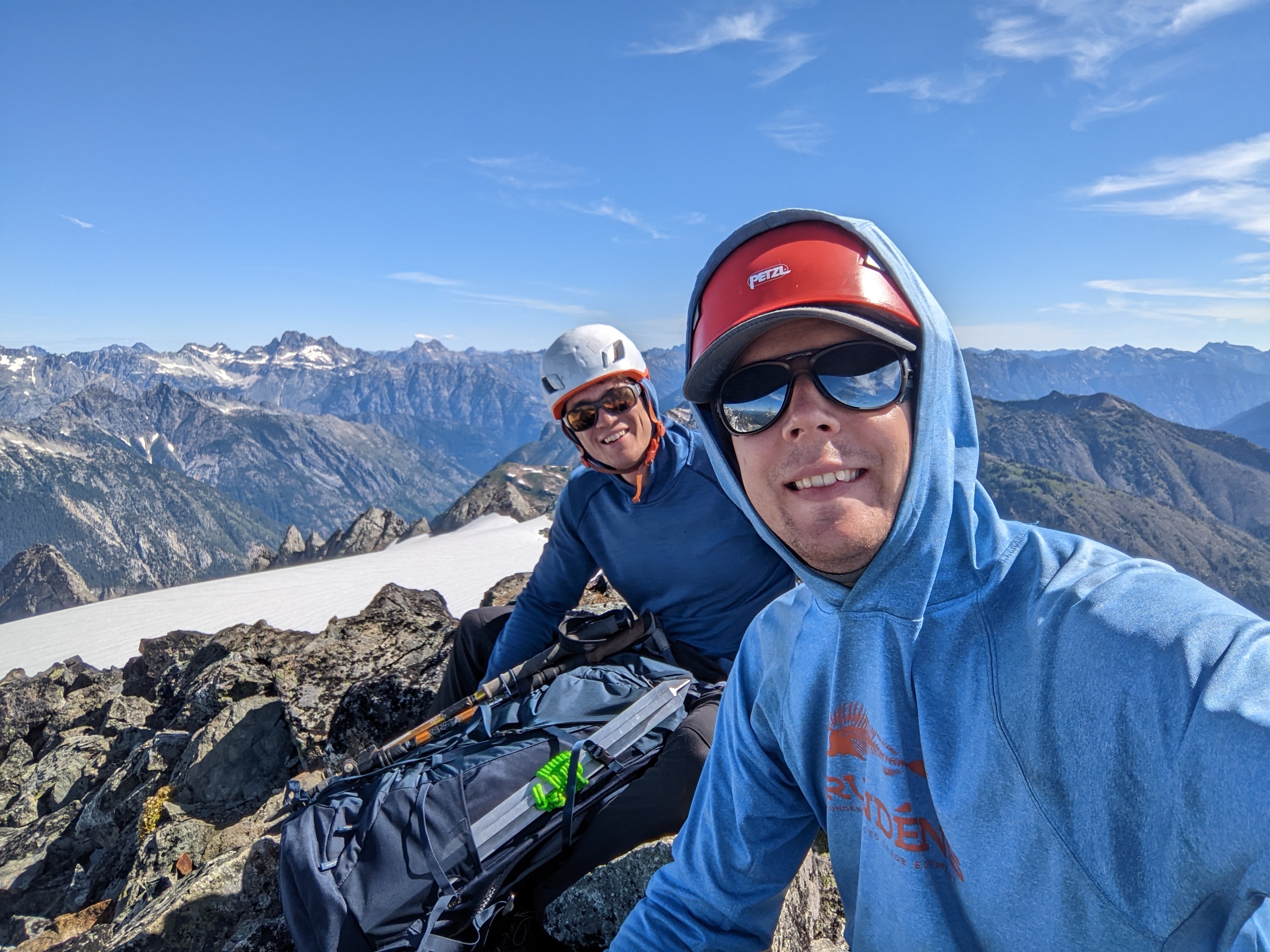
At the saddle with Le Conte, we crossed the glacier and summited Old Guard Peak.

We made quick time back over Le Conte and quickly dropped into the right drainage. The initial 1000 feet down were easy, no trees, boulder hopping across trickling streams fed from snowmelt.

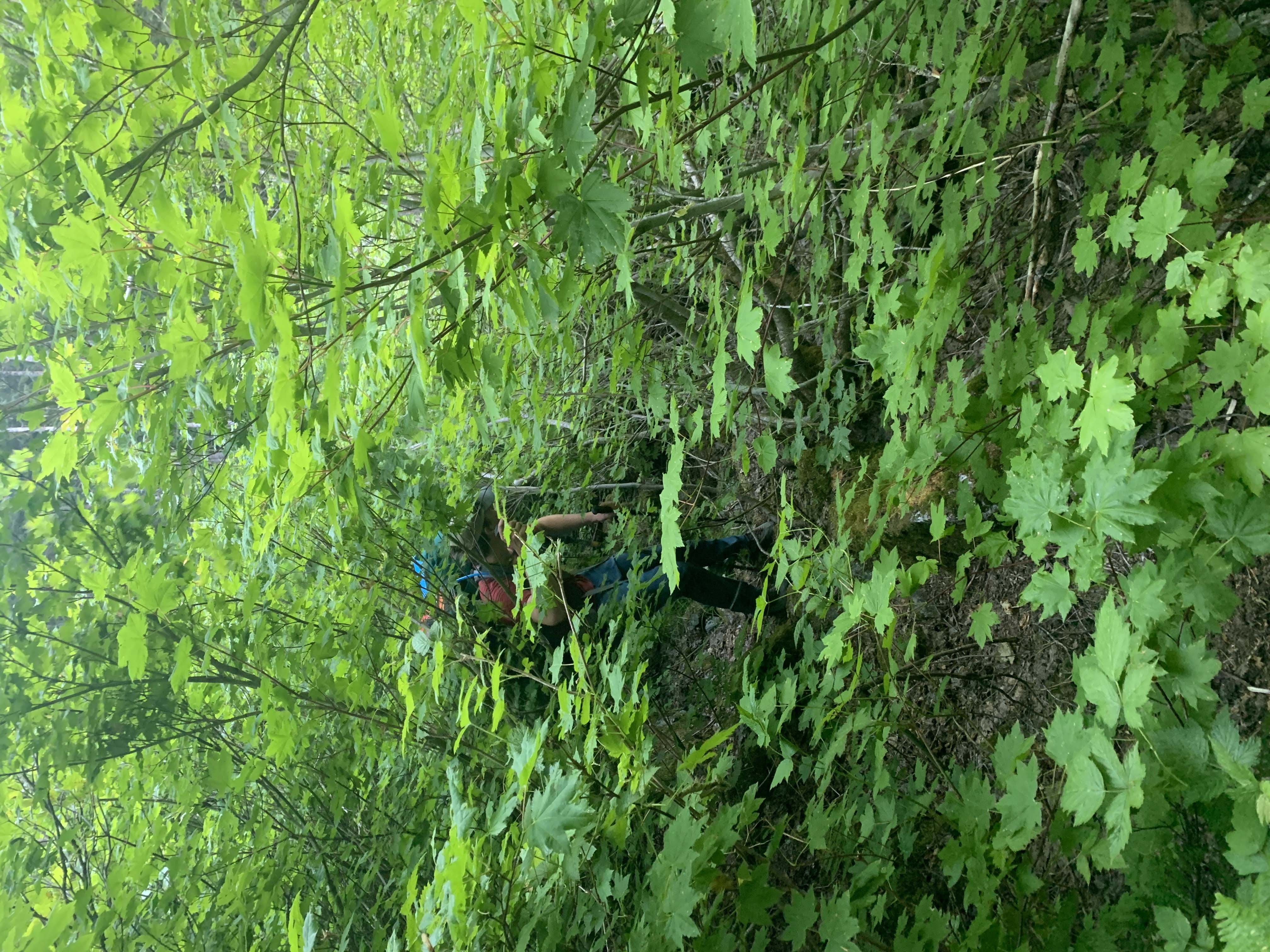
Once we hit trees, it quickly became impossible to plan more than a few feet in advance. We hit a cliffband overlooking a waterfall and circled around where we hit…steep trees. These trees were improbably clinging to a 45 degree slope, trucks curved sharply towards the sun. After we both slipped down the hill and caught ourselves on trees, we decided that we needed to use the rope to safely lower.


Once we navigated the trees, we had some heinous bushwacking along the river to get to more open forests. Finally, around 7:30pm, we found a flat spot along the creek and setup camp, exhausted.
Day 5 - Out!
In the morning, we continued our way out along the creek, navigating nasty, overgrown bushes often complete with nettles and thorns.